City Scan: Data-Driven Design for Climate-Neutral Neighbourhoods
Urban design tool helping cities shape and evaluate sustainable urban futures
Region
Europe and Northern America
Date
2023-2026
Service
Studies, Research, and Capacity Building

Project Details
Location
- Granollers (Spain)
Type
- Commission
- Research
Client
Partners
- Aquatec
- Granollers Town Council
Surface
120ha
Cities face increasing pressure to deliver climate-neutral, resilient, and inclusive urban environments - yet conventional planning processes remain slow, fragmented, and reactive.
This global urgency forces us to confront two central questions.
How do we build the city of tomorrow, and how do we do it today?
In response, TSPA has developed City Scan, a parametric planning tool that reimagines how urban development is conceived, evaluated, and implemented.
Developed within the UP2030 project, a Horizon Europe funding programme, City Scan integrates design, analysis, and feedback into a single, dynamic planning workflow. It streamlines the conventional urban planning process, replacing linearity and intuition with data-driven transparency and real-time optimisation.
What Is City Scan?
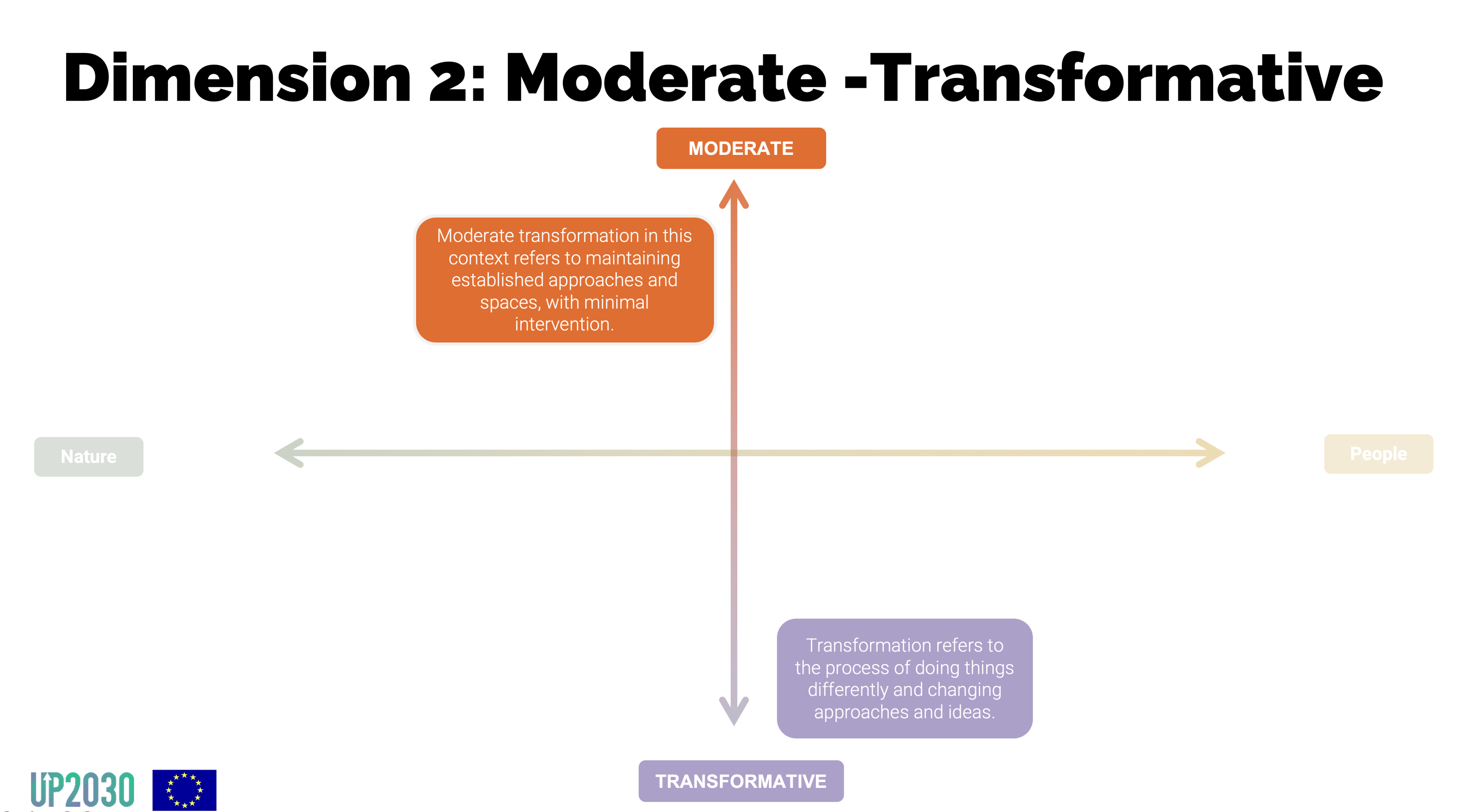
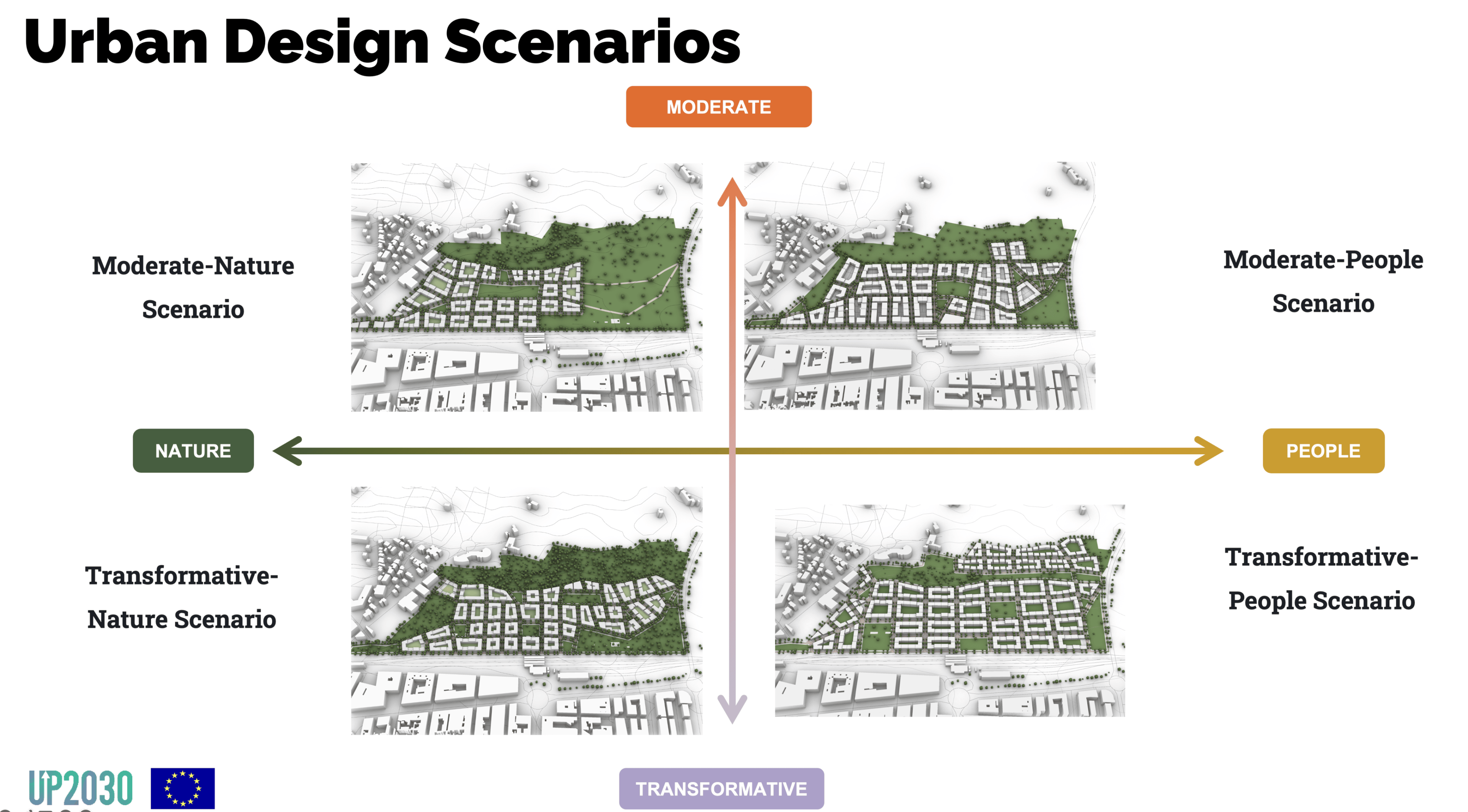
City Scan is a parametric modelling and assessment tool for urban design. It enables planners to generate and test spatial scenarios based on customisable parameters such as density, land use mix, mobility networks, or green infrastructure. Each scenario can then be analysed using environmental and spatial indicators aligned with local sustainability goals or community needs.
It is not a real-time simulation engine. Rather, it provides a rapid, iterative process for producing design options and evaluating their implications across a range of metrics - such as accessibility, energy use, urban greening, and climate resilience.
How Does City Scan Work?
Traditional urban planning often unfolds as a sequential process, moving from needs identification and contextual analysis to brainstorming, concept development, and design iteration. While methodical, this approach can be slow, rigid, and disconnected from real-time feedback.
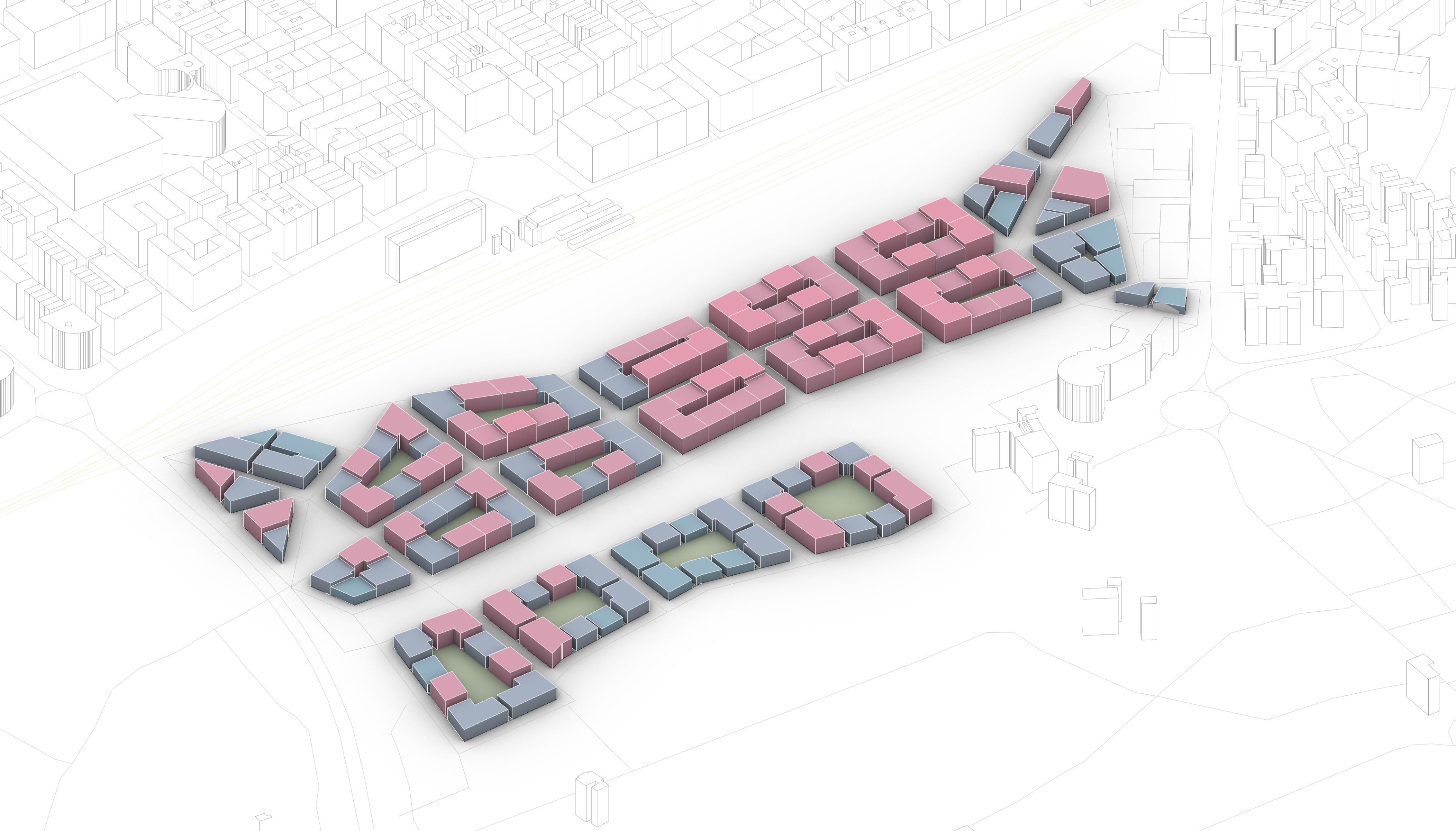
City Scan transforms this model into a non-linear, parametric workflow. By integrating key stages of the planning process into a single interface. City Scan combines spatial generation and impact assessment in one workflow. With it, urban planning teams can:
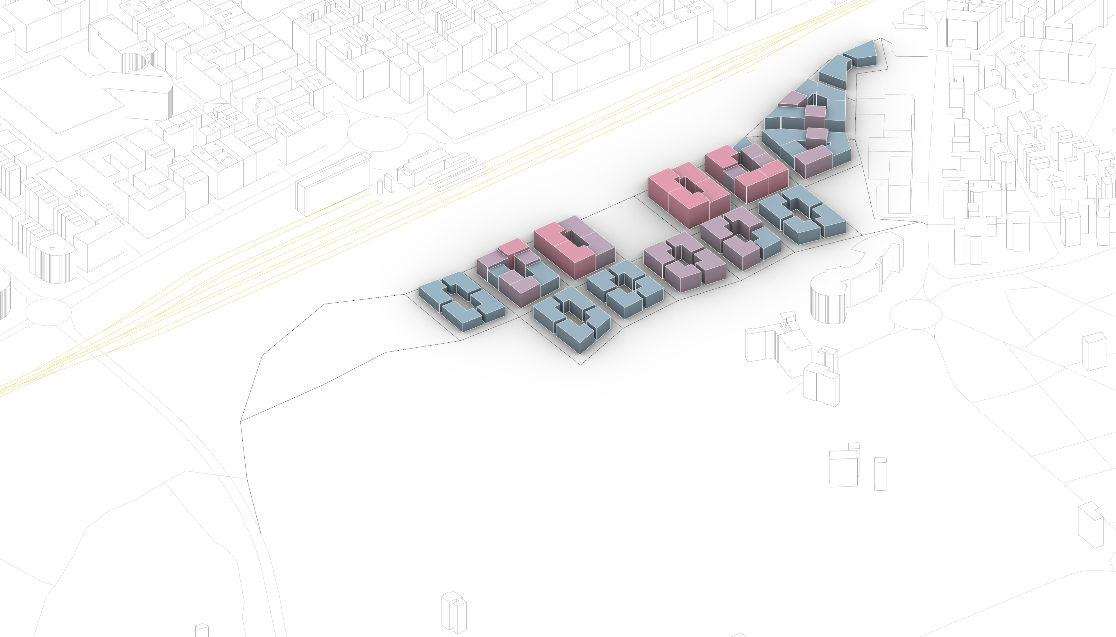
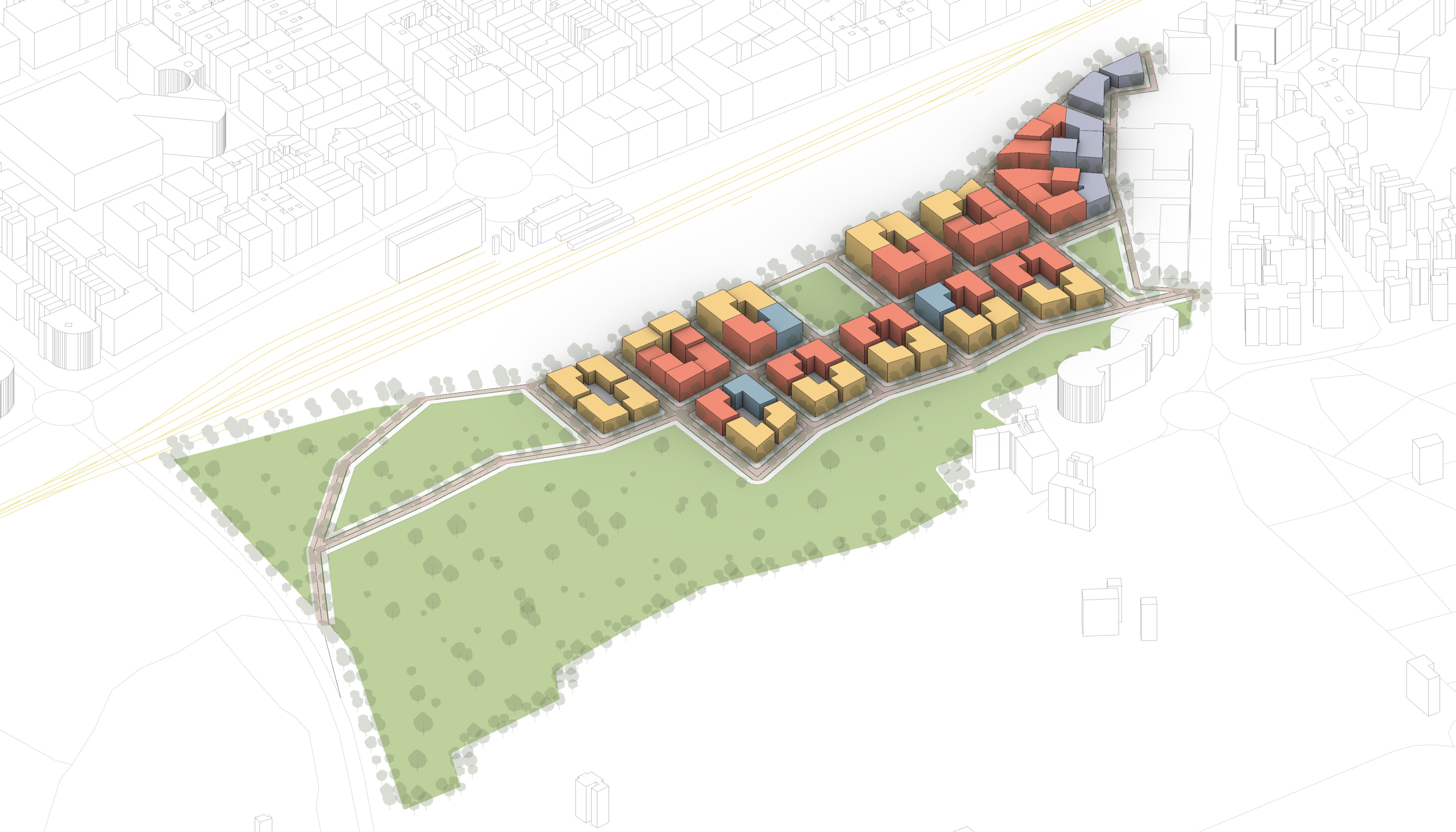
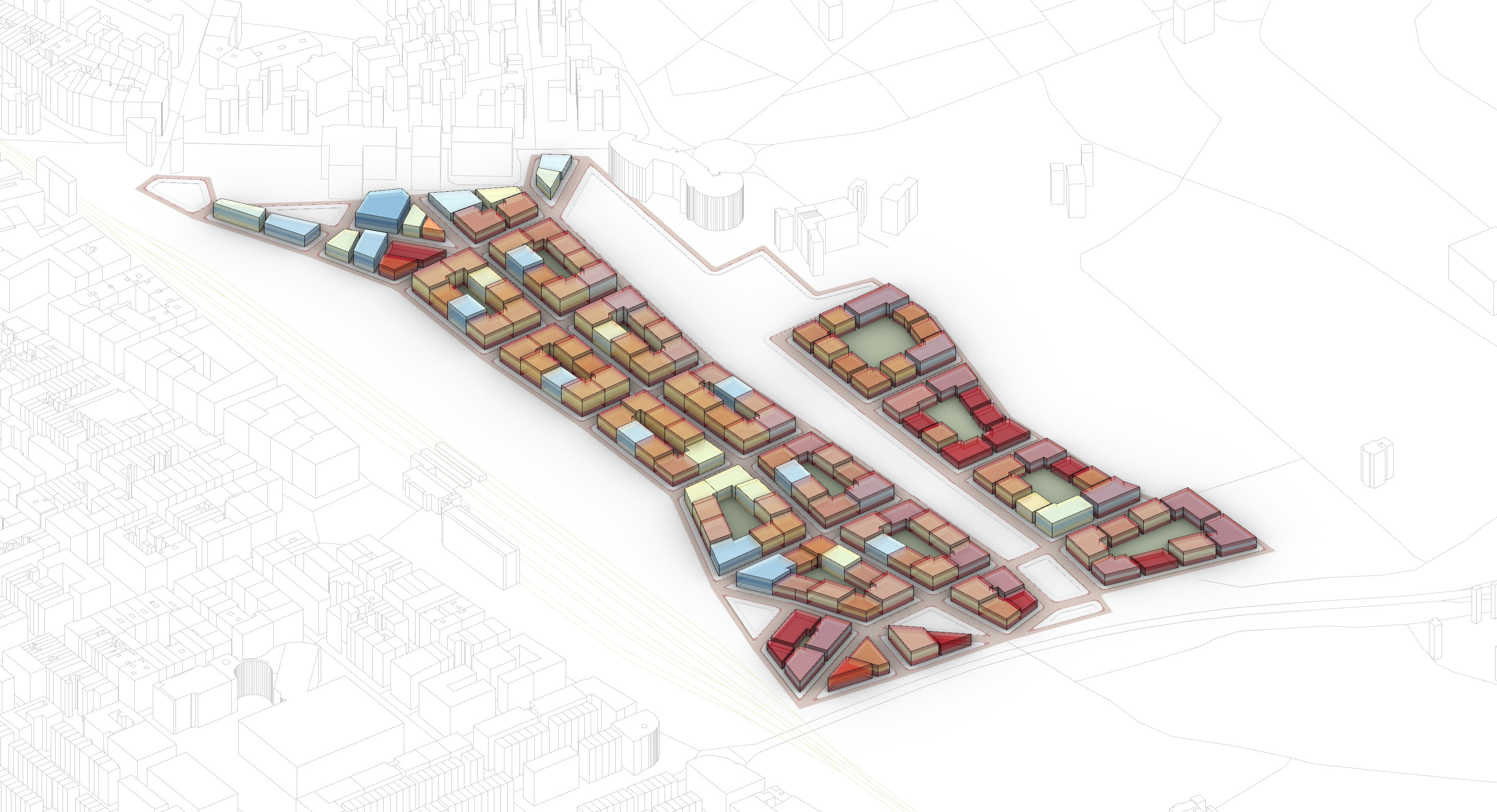
- Create alternative urban layouts with controllable parameters (building heights, land uses, street grids, public spaces).
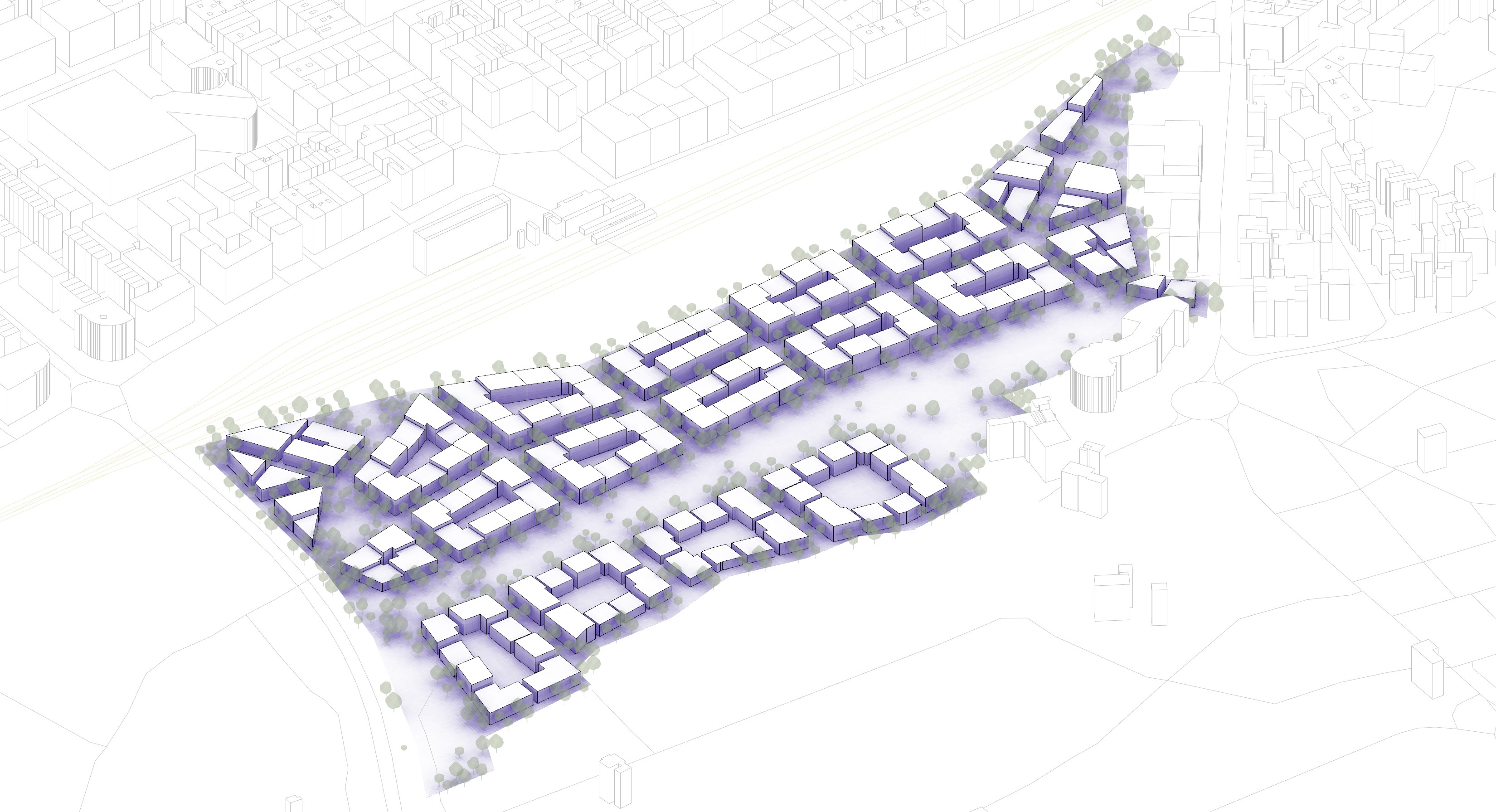
- Visualise key spatial patterns in 2D and 3D formats, including block structures, open spaces, and circulation routes.
- Support co-design processes by producing tangible, comparable outputs for workshops and consultations, by instantly testing and compare urban development scenarios.
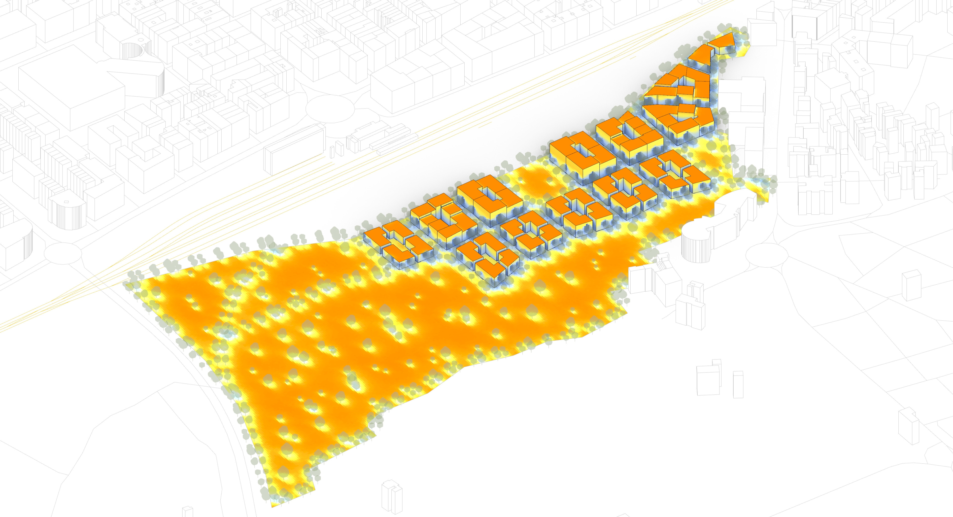
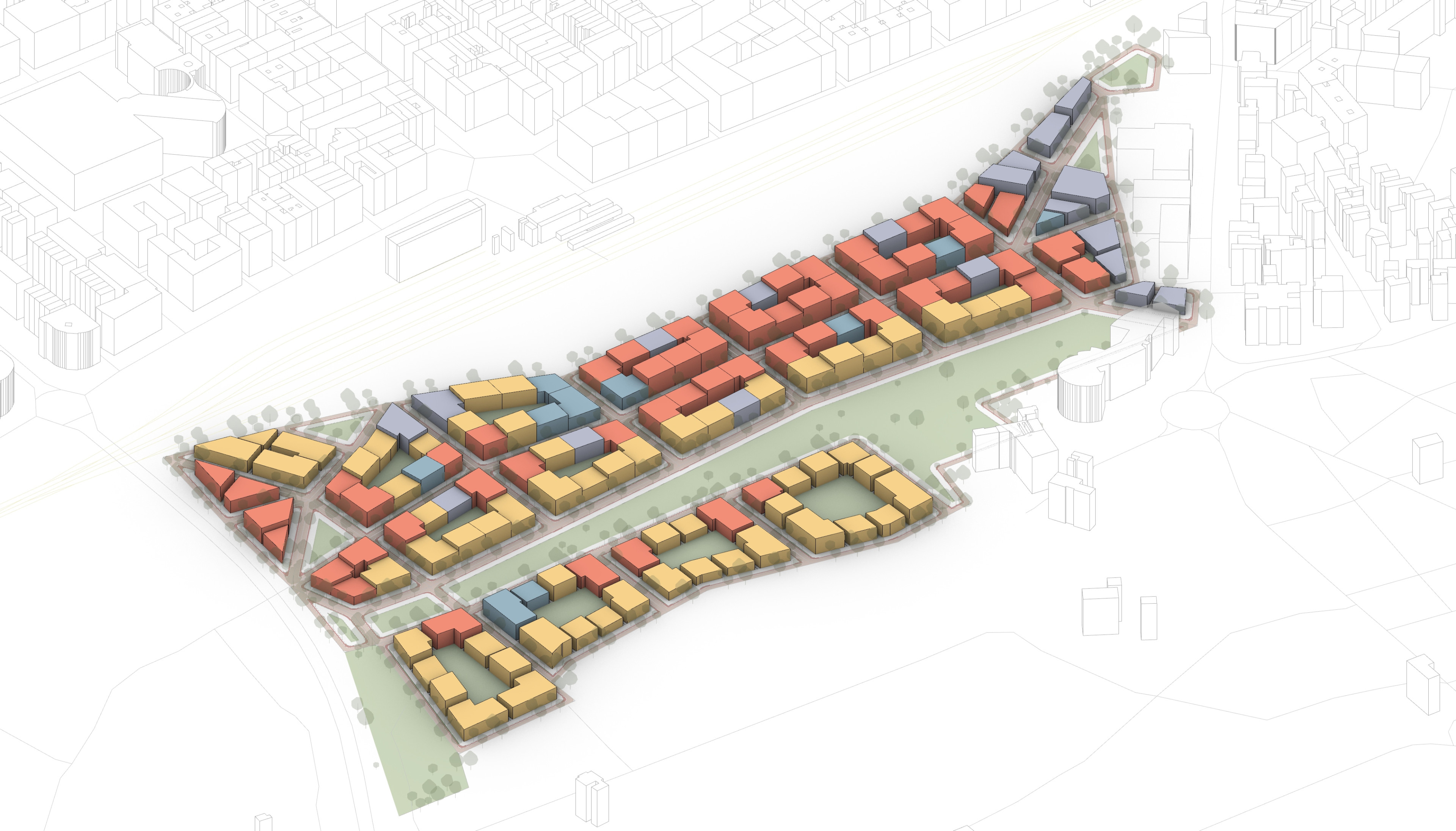
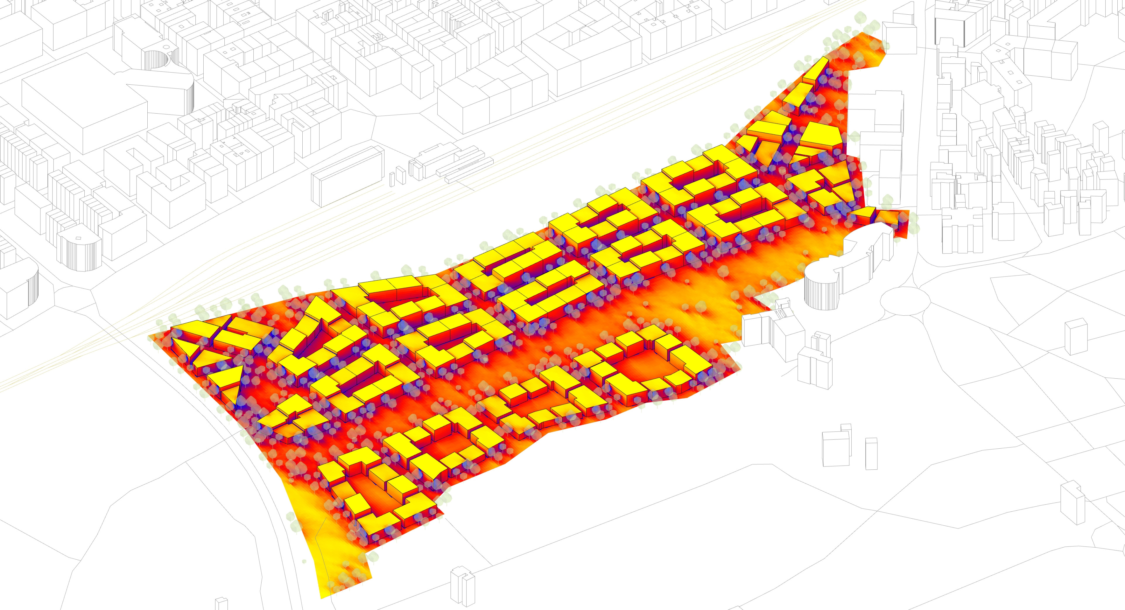
- Assess performance indicators such as:
- Energy demands (cooling, heating electricity, lighting)
- Solar exposure (solar gain and radiation)
- Access to green space
- Walkability and connectivity
- Land use mix and density
The result is a faster, more adaptive planning process, one where urban design proposals can be created and refined in hours rather than weeks, with environmental and spatial outcomes visible from the outset.
Parametric Modelling for Urban Planning
At the core of City Scan lies parametric modelling, a design technique that allows geometries and systems to adjust based on a defined set of variables. In City Scan, these parameters are user-controlled, giving planners full visibility into the impacts of their design choices.
This makes the planning process more transparent, collaborative, and responsive. Users can instantly assess tradeoffs, optimise key outcomes, and adapt plans based on evolving policy goals or stakeholder feedback.
While parametric modeling is often used in architecture or building design, City Scan is one of the first tools to apply this methodology at the urban scale, combining both design and environmental simulation.

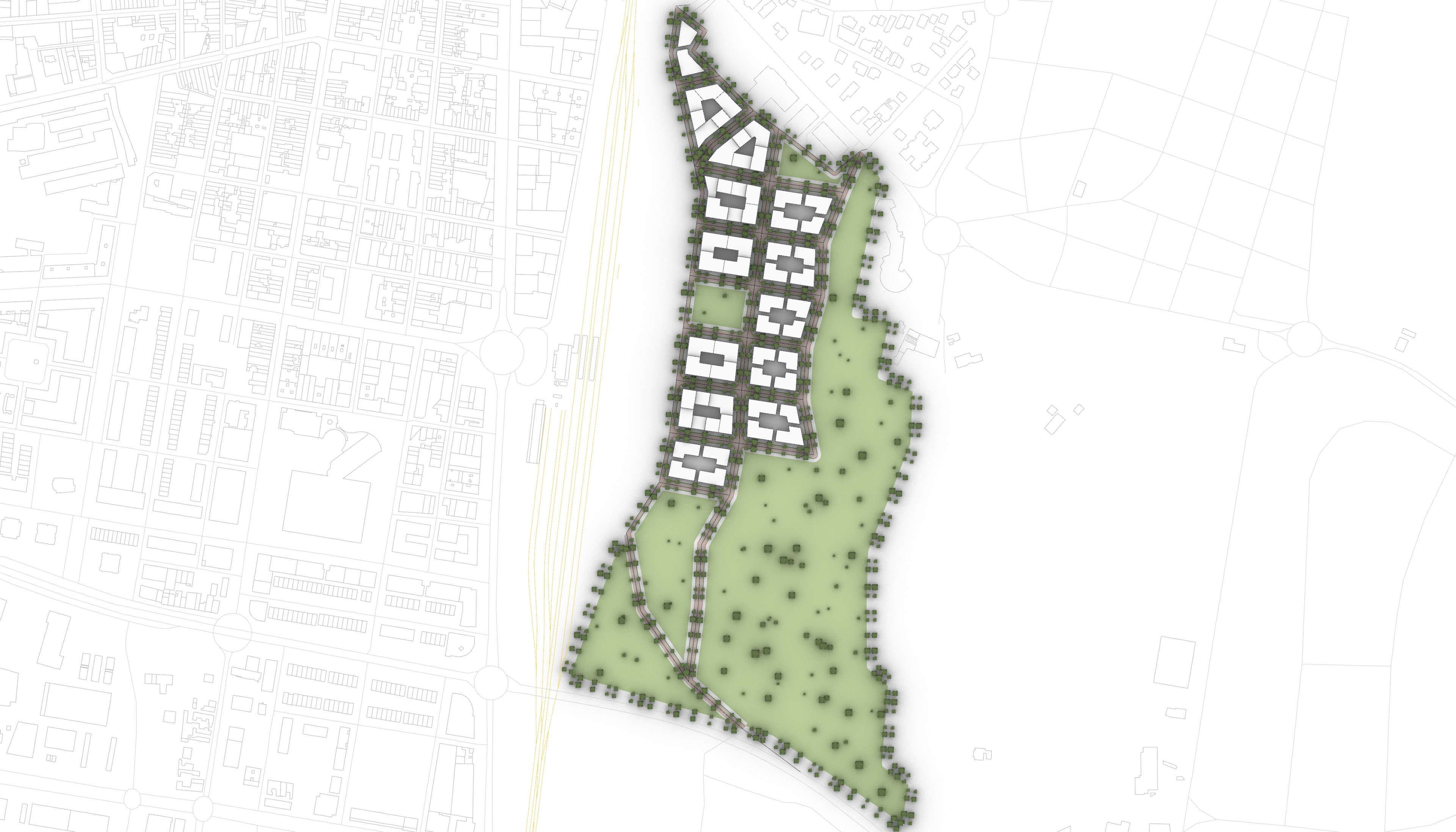
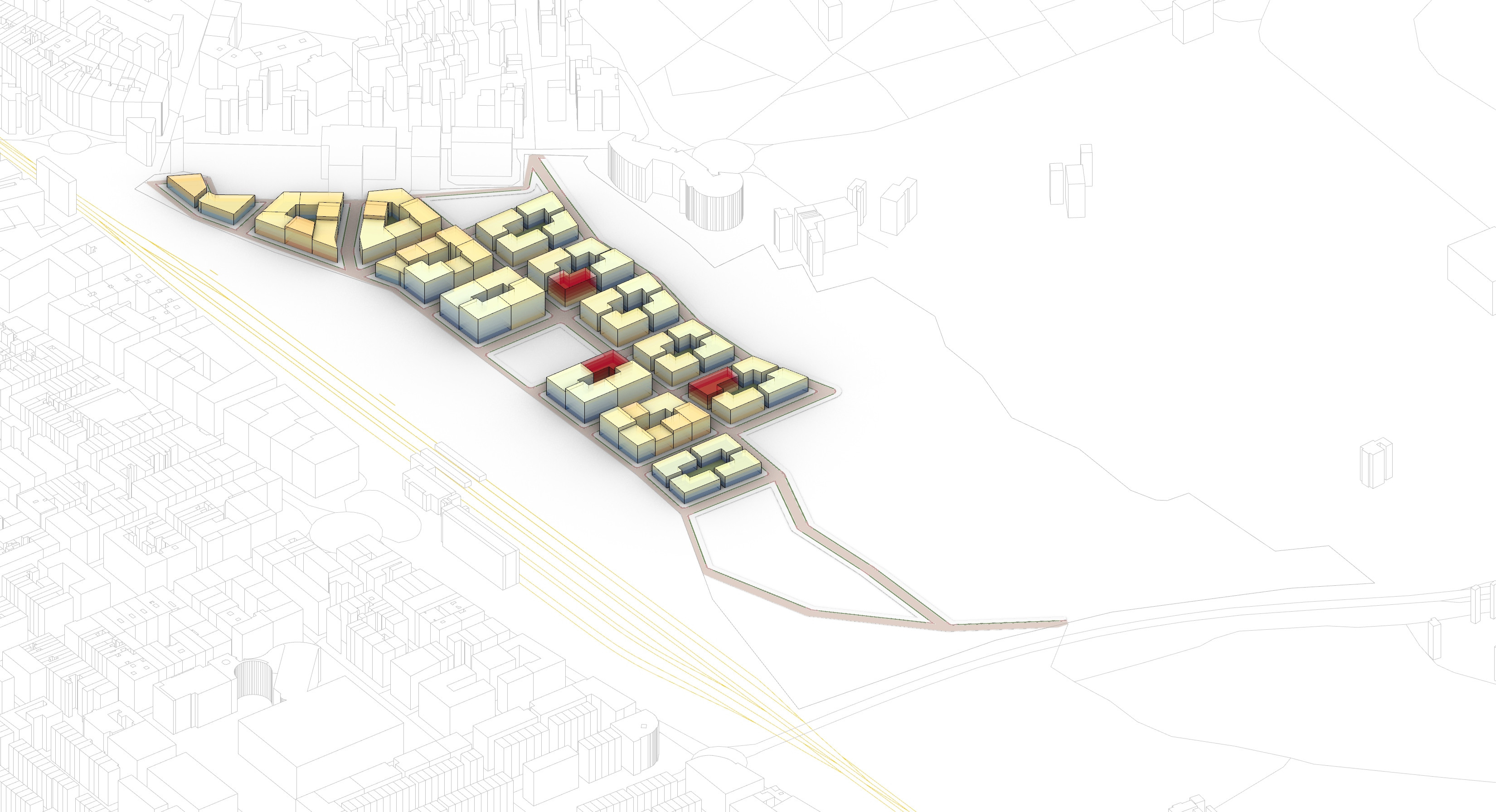
Grounded in Practice: The Granollers Pilot Project

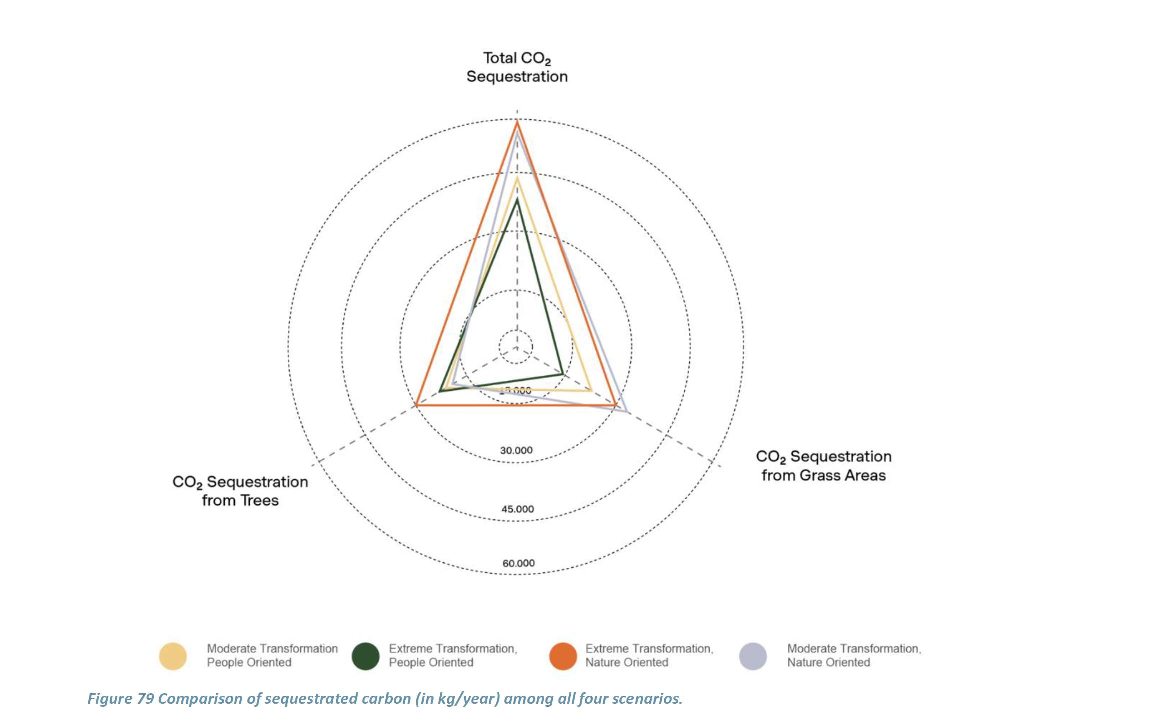
In the city of Granollers, City Scan was applied to the La Bòbila neighbourhood, a future development area where urban form, density, and sustainability strategies had not yet been defined. The goal was to support the city in developing a pilot prototype for achieving Granollers vision of 'Resilient and sustainable neighbourhood with opportunities for everyone'.
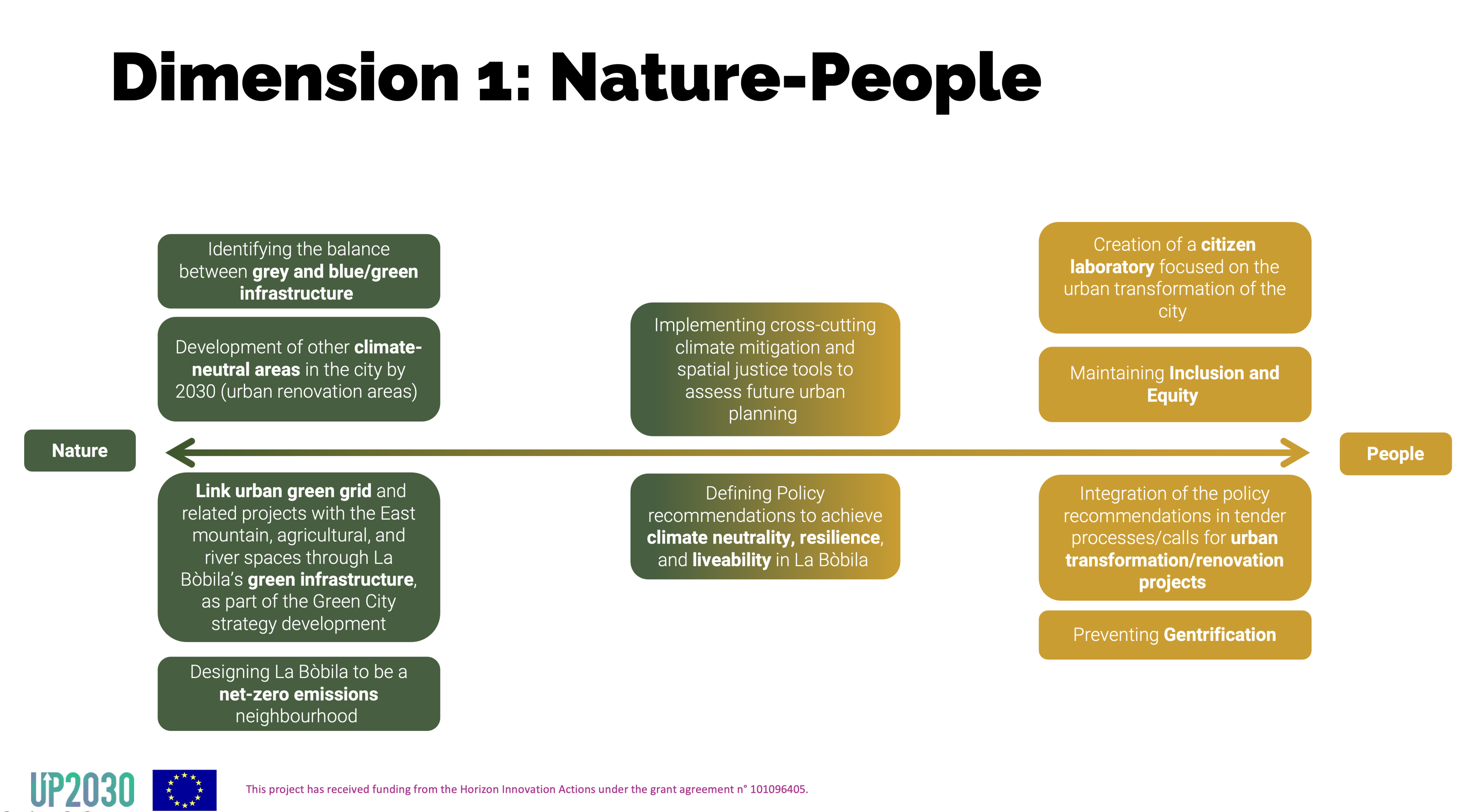
Working closely with the municipality, TSPA used City Scan to generate a range of alternative urban design scenarios, adjusting variables such as street layout, building heights, land use mix, and public space allocation. These scenarios were then analysed using key indicators aligned with the UP2030 project pillars: carbon neutrality, resilience, and just transition.
The process began with the matching the city’s objectives and the development of a structured scenario matrix, outlining key principles to guide spatial strategy development. This matrix provided a framework for exploring different planning directions while remaining anchored in the pilot’s climate and inclusion goals. A series of brainstorming sessions followed, to sketch early design ideas, tested spatial configurations and map spatial constraints and opportunities within the La Bòbila site. These sessions ensured that each scenario generated by City Scan was not only technically sound, but also intentionally aligned with the city’s strategic priorities and local context.

The tool was used to:
- Generate urban design scenarios with varying levels of compactness, greenery, and mixed use.
- Evaluate each option with regard to carbon neutrality, resilience, and social inclusion.
- Present outputs during the stakeholder workshops, supporting local authorities in building a shared vision based on evidence rather than assumptions.
The outputs of the tool, together with findings from RESCCUE tool, were used to inform urban design guidlines for developing new urban quarters in the city.
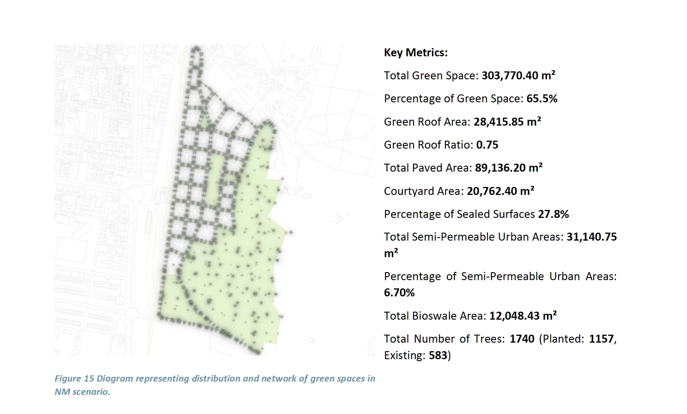
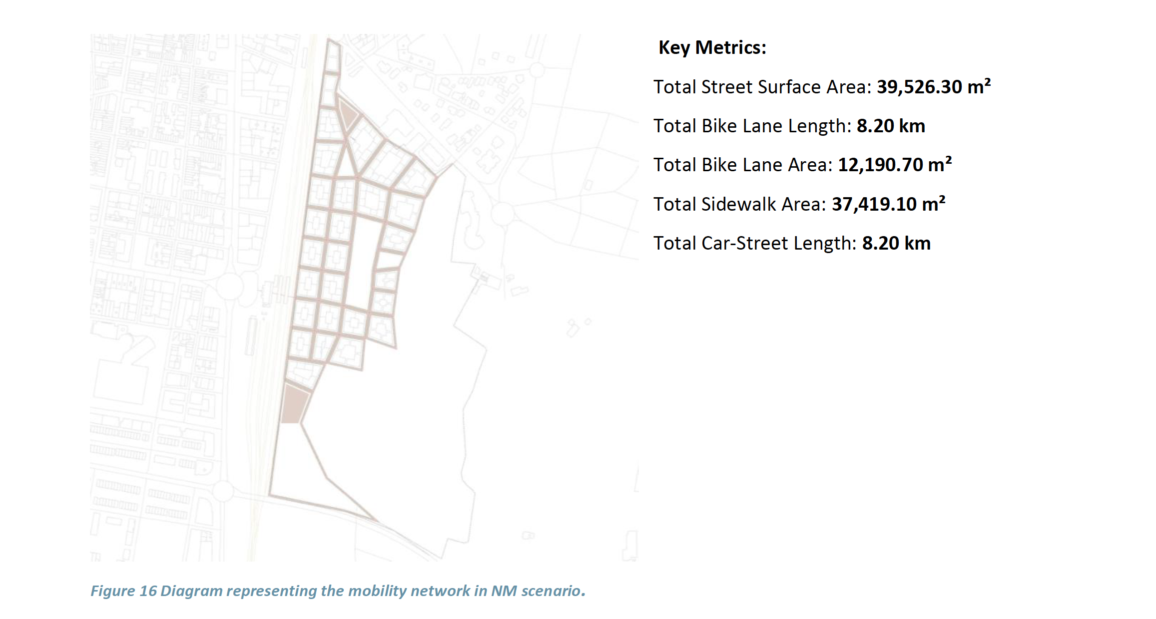
The tool provided not only spatial maps and 3D views, but also quantified indicators that helped assess trade-offs between goals - for example, between green space provision and housing density, or between mobility accessibility and land take.
Design and Analytical Outputs
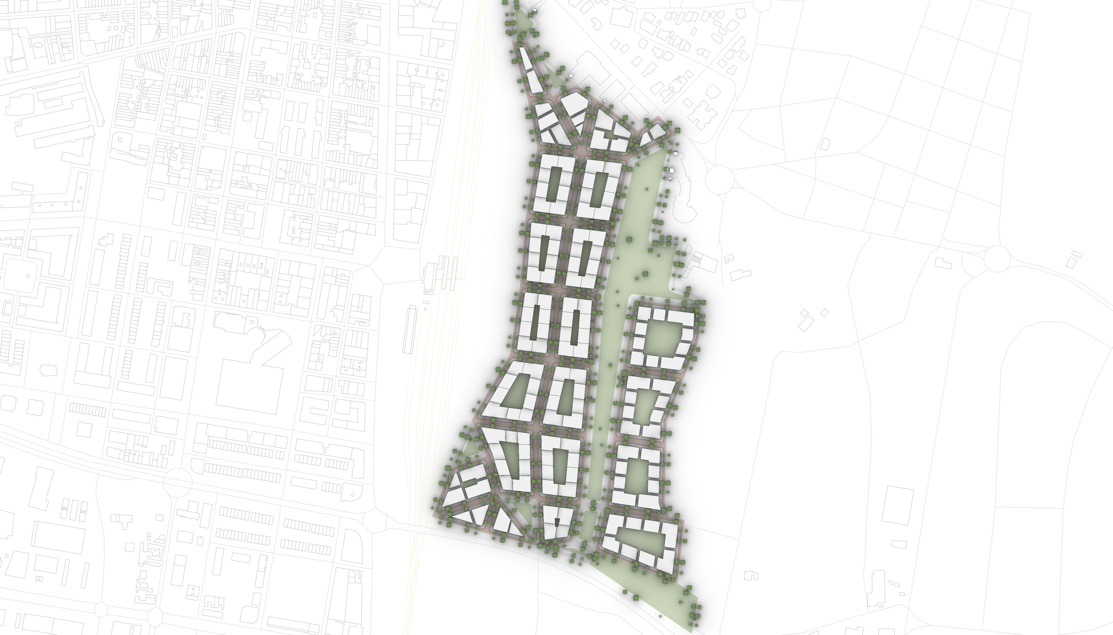
City Scan produces two main output types:
(1) Design Scenarios: These include three-dimensional spatial layouts and maps that visualize key urban elements, such as block structures, public spaces, mobility networks, and surface treatment.
(2) Analytical Outputs: These evaluate the spatial scenarios based on selected performance indicators, including accessibility metrics, land use density, energy performance, and mobility flows.
This dual output structure enables users to see not only what a plan looks like, but also how it performs, a critical advancement for data-informed and sustainability-oriented planning.
Co-Designing Neighbourhoods
Because of the ability rapidly generate different urban design simulations, City Scan also contributes to participatory planning by making stakeholder engagement more interactive and visual. Whether working with citizens, policymakers, or private developers, City Scan allows users to modify design scenario, visualising trade-offs and making them tangible and conversations more grounded in evidence.
For instance, if a municipality wants to increase green space coverage in a specific neighbourhood, City Scan can show how this goal might affect other indicators such as housing density, parking allocation, or walkability.

Planning for Resilient and Inclusive Cities
City Scan is more than a digital tool. It is part of a broader planning methodology that supports cities in transitioning toward climate neutrality. By embedding scenario testing and evaluation into the early design phase, it helps:
- Structure decision-making around clear objectives and measurable impacts.
- Bridge analysis and design, enabling cities to move beyond intuition-led processes, and embed environmental feedback and socio-spatial indicators directly into the design process
- Increase transparency in planning processes and build trust with stakeholders.
As cities work toward ambitious carbon neutrality goals, tools like City Scan can play a critical role in aligning local action with global sustainability targets, creating cities that are not just smarter, but also fairer and more resilient.

City Scan is part of our commitment to making planning more transparent, responsive, and grounded in measurable impact. It gives cities the tools to explore different futures - and the evidence to make informed decisions. If you're working to translate climate goals into urban form, or looking to structure decision-making across departments and disciplines, we invite you to explore how City Scan can support your process.
Get in touch to learn more about how the tool has been used - and how it can be adapted to your co


